Cycling the Via Appia ↑ all posts
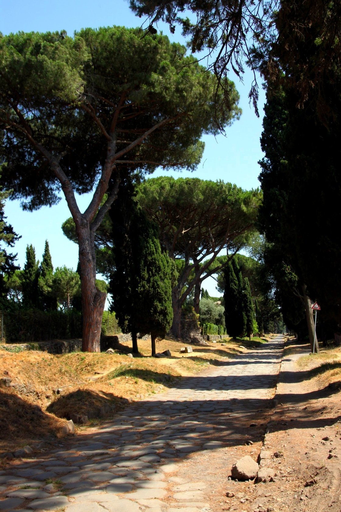
On the bike and following the Via Appia southwards to the coast at Terracina. Just a mile or two from the center of Rome there is a long stretch of the original road, the Appia Antica. The huge hexagonal flagstones which make up the surface of the road are impossible to cycle on with a road bike, but there is a dusty singletrack leading alongside most of it which I can deal with. This stretch of the road on the outskirts of Rome is lined with tombs and catacombs, prime real estate for the Roman dead.
After a few miles I switch to the newer Appia Nuovo, a modern road running in parallel to the old. It heads into the countryside and begins some long climbs into the hills to Valletri and Cisterna di Latina. The Via Appia cares nothing for switchbacks, it ploughs straight up and down these hills while the modern road snakes from side to side on the steeper sections. You can see the flagstones of the old road at the edge of every hairpin turn.
From Cisterna di Latina the road heads straight to Terracina on the coast. Really straight to it. It’s the longest stretch of straight road in Europe: 62 km through the old Pontine Marshes. The Romans tried unsuccessfully to drain these foul smelling, malaria ridden marshlands, but gave up and built the Via Appia on a raised causeway. Nowadays a series of drainage channels and pumps keep the area fairly dry and most of it has been converted to farmland.
The entire 62 km stretch is lined with the iconic Roman umbrella pines, providing much needed shelter from the sun. Every so often side roads join the Via Appia and through the middle of the roundabouts the old flagstones are still visible.